Check out our presentation on 3D GPR
During early February 2026, New Zealand Stopbank Services presented at the International Geomorphology Conference. We have outputted a video of this presentation for you to see!
Whether you interested in what the ground is doing, or what unforseen obstructions may be awaiting your next excavation, we can help.
And check out this presentaiton on Stopbank Engineering
This presentation was given to the Christchurch Branch of the New Zealand Geotechnical Society (NZGS). Thanks to Izak and PDP for this opportunity.
SERVICES
Stopbank design
The many sssss’s to assess:
• Seepage
• Scour
• Slope stability
• Sliding
• Seismicity
+ more
• Ground investigations
• Laboratory testing analysis
• Compaction control
• Excavation stability
• Geotechnical treatments

Engineering Inspections
Something’s not quite right with your stopbank, you know it, but what is it?
Call in the experts. Sometimes we see things, sometimes its a matter of deduction, sometimes we simply talk to you and the solution presents itself! Sometime we must drill, scan, probe, soak or inject, but whatever we do, we work towards resolve.
Stopbank advice
We know what is current best practice, frequently working in and out of guidelines, standards, rules, plans and published literature including:
• Regional plans
• RMA
• Soil Conservation and Rivers Control Act
• NZS1170.5, NZS9401, NZS441, NZS4402
• Austroads
• Council guidelines
• FEMA, USACE, CIRIA

Condition Assessments
We can work to your platforms, to conduct anything from rapid assessments to full scheme condition assessments.
This helps meet your ‘qualitative level of service’ requirements, and to acheive this, we can methodically pick apart your flood protection network, so that historic land-use, paleo-channels, vegetation effects, buried services, interfacing of external infrastructure and adjacent activies, can all contribute the asset condition score.

Bylaw authorities
Don’t go building by flood defences! But, if you really must, speak to us.
Some points to consider if planning to do work by a stopbank are listed; these help define what can be expected.
- Will an excavation result in lower ground elevations that short-circuit a seepage path, or promote heave?
- Will you need seepage filtration measures around foundations and penetrations?
- Do you have farm gates near the stopbank toe which attract soil compaction from farm machinery and stock movements?
- Is there a tree topple hazard?
- Are buried services involved, and if so, can these go over the stopbank so they are only buried in the freeboard?
STAYING UP-TO-DATE
“An overview of how we stay informed"
Within the realm of flood protection, the depth of technical expertise stretches far beyond just us. And this is refelcted in the significant number of training courses that are at our disposal, some of which we rely on include:
• New Zealand Rivers Group
• New Zealand Geotechnical Society
• Australian Water School
• Wider Engineering New Zealand Scene

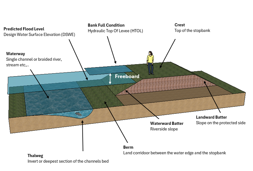
STOPBANK SPECIFICS
“Engineering talk, some frequently used terminology"
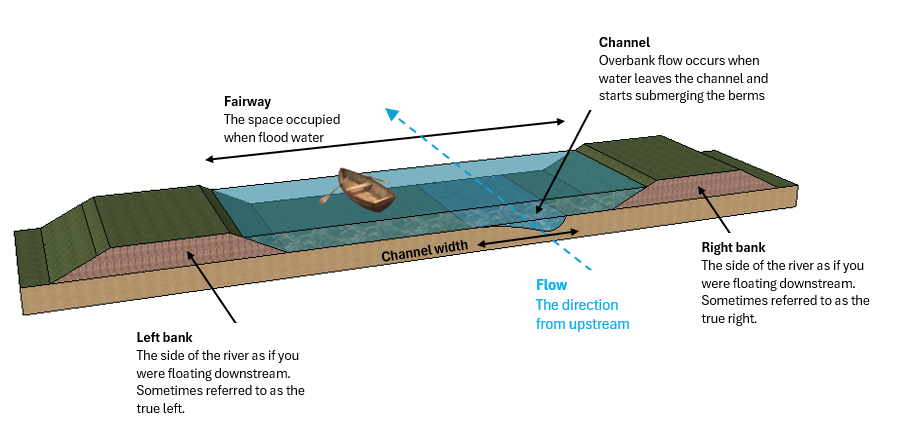
Stopbank = Same as an floodbank, embankment, levee, dyke. Use to control and direct floodwater.
Floodwall = A concrete, plastic, steel or other material, used to form a wall and with-hold floodwater.
Flapgate=Usually a hinged flap on the end of a culvert to stop floodwater backing up, (sometimes called a floodgate).
Culvert = In this case, a pipe that can pass storm-water or drainage flows through a stopbank that must be fitted with a seepage filter and not constructed on a permeable bedding layer.
Flood barrier = A temporary flood measure such as an inflatable bund or modular-watertight-fencing.
Penetration = Some type of service line or buried infrastructure that passes beneath part of a stopbank or other flood defence.
Batters = The side slopes of a stobank
Crest = The flat top of a stobank
Shoulder = Either side of a stopbank crest where it merges with a batter.
Toe = The end of a stopbank batter where it merges with ground or the waterway.
Groyne, spur or retard = A rock rip-rap arrangement used to protect a local vulnerability, or attempt to deflect the flow.
AGPR=Armour Grade Protection Rock; Used for rip-rap, revetments or energy dissipation.
Seepage treatment = Methods to control the movement of sub-surface water flow caused by the floodwater.
Overtopping = When water goes above the crest of a flood defence (could be from wave action, afflux). Simlar to overflow with the key difference is that overflow occurs becuase the fairway is too full.
Breach: When a flood defence fails such that the waterway flows (~unimpeded) into the protected area.
STOPBANK STOPOVER
“A spiel on where to from here"
When we live and develop by rivers, we begin this delicate tussle of trying to control nature. We know rivers want to do their own thing, but as engineers we are here to control them. How we acheive that, can take a variety of forms. Hard structures (concrete) have their place, and soft measures (riparian management) certainly does too. Each site, each river, will demand different solutions, and there are always evolving ideas to better accomodation floodplain management.
Some things we take interest in, or currently are doing include:
• Using thermal camera’s on drones for vermin detection, primarly the presenceof rabbit warrens.
• Live groundwater monitoring using piezometer data, that feeds straight to our devices for real-time flood monitoring of seepage hazard.
• Laser weldeing rock and sediments, to create on-site rip-rap or to heal damaged AGPR.
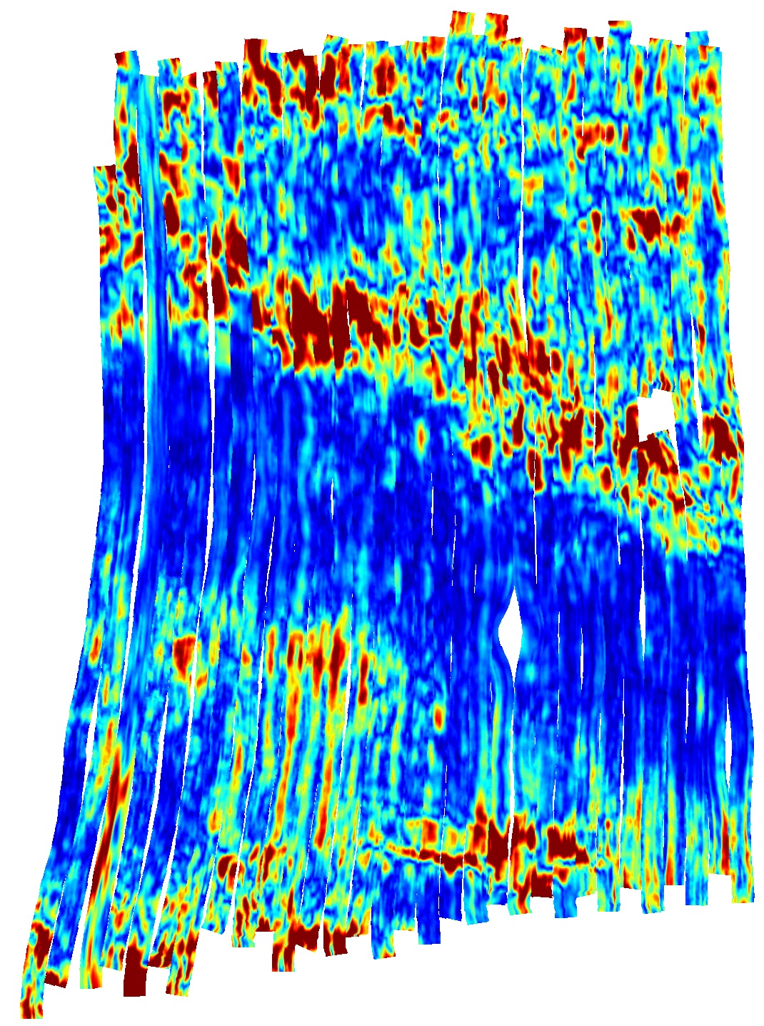
• 3D GPR interpretation to compliment peppered 1D intrusive testing.
• Anything that helps improve health and safety, particularly during flood-fighting. We’re talking hi-vis dry-suits with integrated PFD’s, satellite communications and internal usb charging. All being puncture proof, chemical resistant, fully repairable, and with perpetually replaceable parts.
GEOTECHNICAL CAPABILITY
The ground and its interaction with surface water is significant. Groundwater on its own has its own set of design attributes, but once you start looking into river connectivity, preferential flow paths, paleo-channels and general hyporheic processes, the situation becomes interesting to say the least. Complex….probable, but things that are complicated are often tied to words like ‘unsolvable, unaffordable, too hard basket’, and we don’t work that way. Therefore, understanding your geotechnical tools, and what are your target parameters, gives New Zealand Stopbank Services some unique appeal. If we can do it in-house, great, otherwise lets pair up with your preferred supplies/contractors/designers to help give them what they need.
At the front end of a project, it coud be discussion around where to place piezometer monitoring chambers, what laboratory tests are needed to get verify you correlations, or what unsaturated/saturated soil relationships you need to constrain. Take the plunge, and get us onboard.
Check out some of our more specific investigation abilities...
-
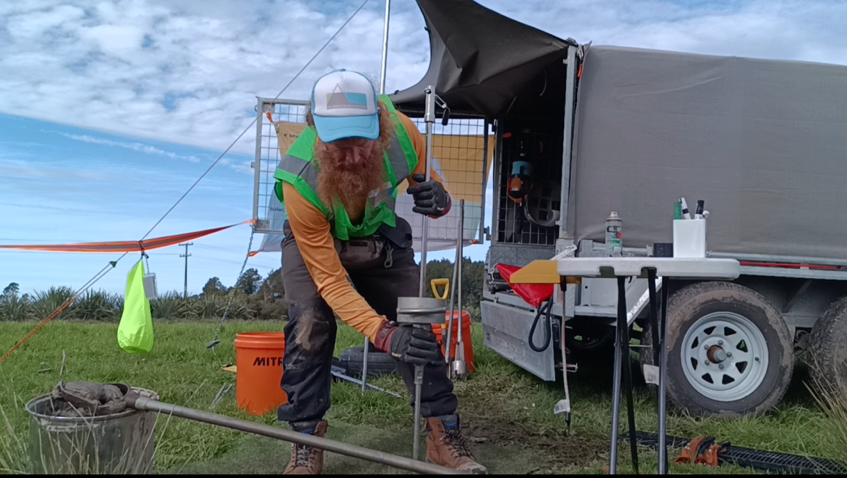
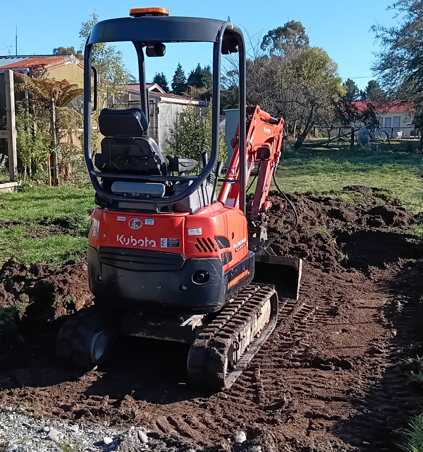
Hand augering: We carry a variety of auger heads, and soil extraction equipment to try get to your target depth.
-
Push tubing: Soil recovering in running sands below the water table can often mean no further advance, we can use push tubes to get deeper, and to collect in-situ samples.
-
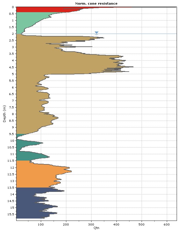
DCP/Scala: If we don’t get to 5.0 m, maybe we have encountered bedrock, or a buried car, otherwise down we go. Continuous profiling does not mean refusing at some pissy criteria like 20 blows per 100 mm.
-
Shear vane: We can collect peak and remoulded field vane readings. This helps understand soil consistency, and comparison of soil types between sites.
-
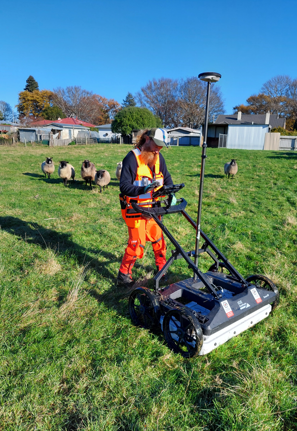
Tomography: Let us collect GPR data to cover your site, enabling plan view slices to infer your ground model.
-
Full GPS recording of swathes for post-processing stake-outs which enables targeted investigation of features.
-
Buried service interpretations in 3D, and service clearances prior to instrusive testing.
-
Quality control for the condition monitoring of your asset over time.

-
Development: Install of piezometer monitroing chambers within target stratum, and well development.
-
Soakge: Constant head or falling head testing for permeability, transmissivity calculations following geo hydraulic equations.
-
Water level data: Install of logging devices into piezo moniting chambers for time-dependant data; which can capture rainfall recharge, tidal effects or other channel data such as pH and conductivity.
-
Calibration: Using water level data we can calibrate the connection between your ground and a waterway. Got a losing or gaining river reach to better understand…our finite element modelling can help.
-
Hand augering: We carry a variety of auger heads, and soil extraction equipment to try get to your target depth.
-
Push tubing: Soil recovering in running sands below the water table can often mean no further advance, we can use push tubes to get deeper, and to collect in-situ samples.
-
DCP/Scala: If we don’t get to 5.0 m, maybe we have encountered bedrock, or a buried car, otherwise down we go. Continuous profiling does not mean refusing at some pissy criteria like 20 blows per 100 mm.
-
Shear vane: We can collect peak and remoulded field vane readings. This helps understand soil consistency, and comparison of soil types between sites.
-
Tomography: Let us collect GPR data to cover your site, enabling plan view slices to infer your ground model.
-
Full GPS recording of swathes for post-processing stake-outs which enables targeted investigation of features.
-
Buried service interpretations in 3D, and service clearances prior to instrusive testing.
-
Quality control for the condition monitoring of your asset over time.
-
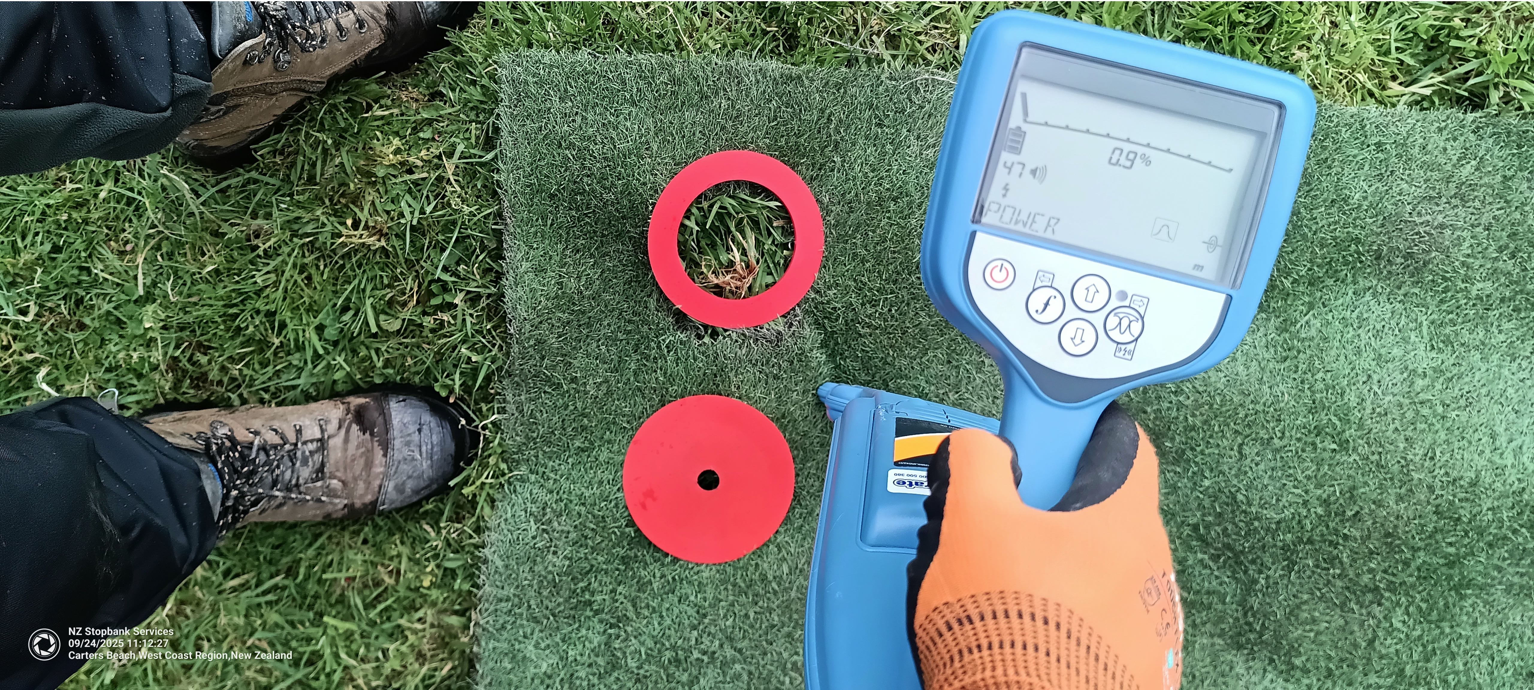
Need to know where your buried infrastructure is?
-
We use cable avoidance tools to locate safe drill areas, or to track your buried services to give surface alignments.
-
-
Maybe its as simple as sweeping the ground with a metal detector. We carry those too.
We are an engineering consultancy dedicated to solving the unsolvable problems of New Zealand’s floodscape.
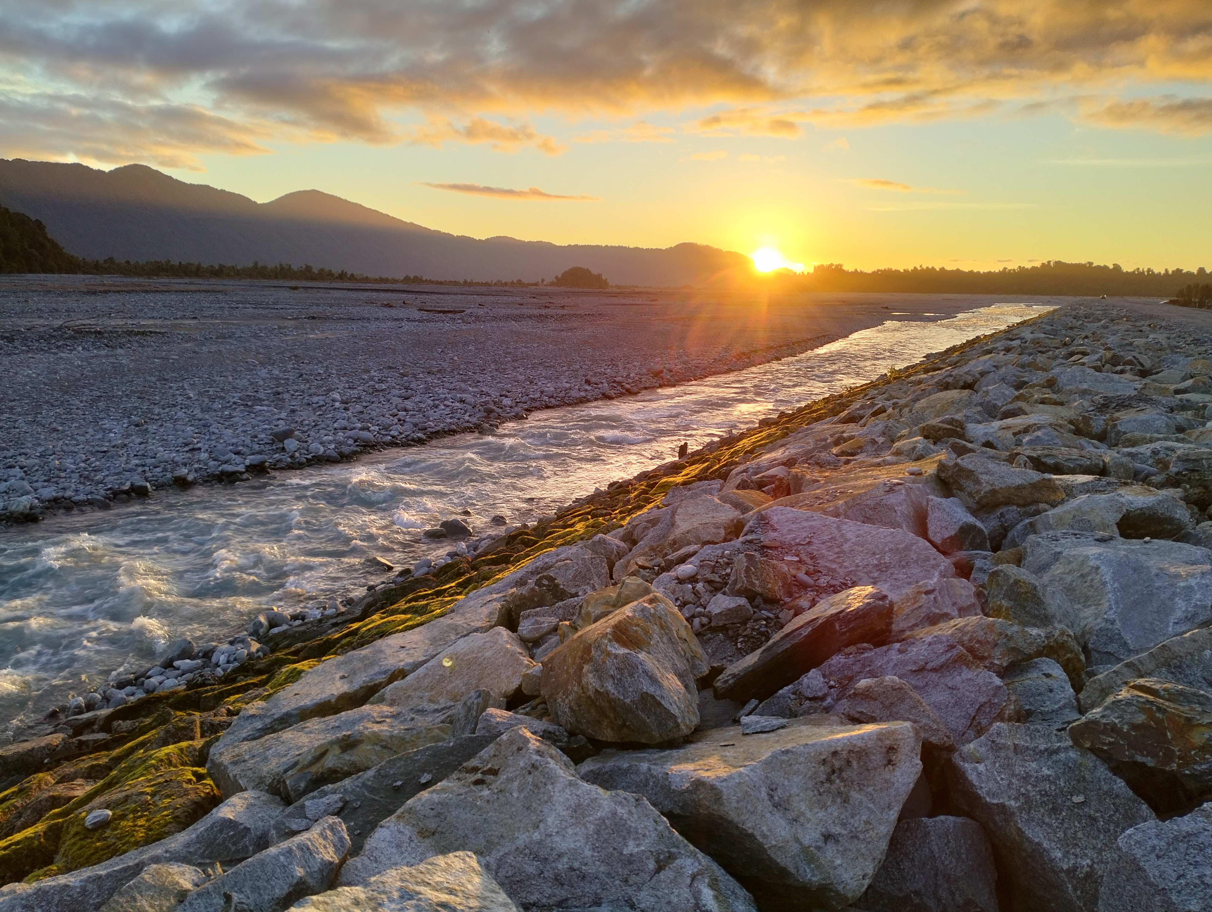
Having lived and practiced in Hawke’s Bay, Bay of Plenty, Canterbury and the West Coast, we don’t have to go too far back in the records too see where floods occur.


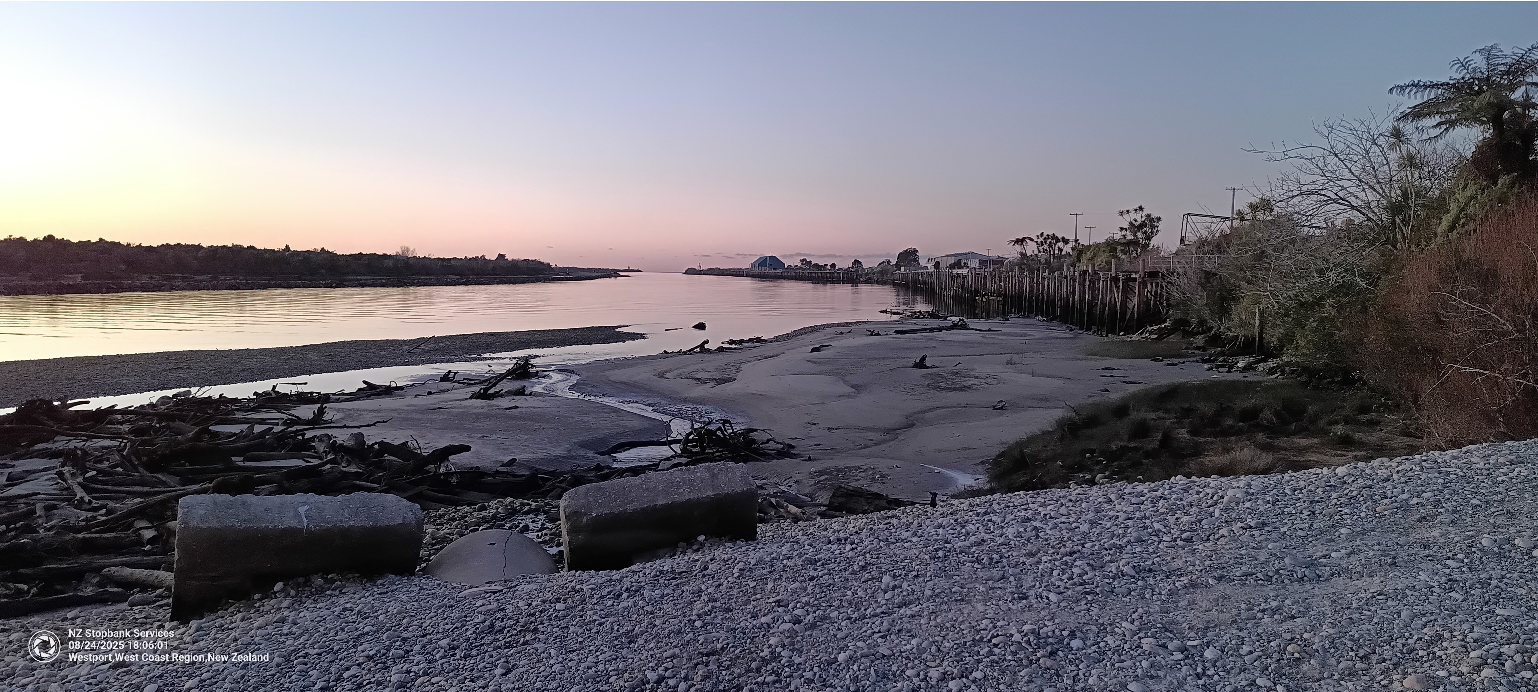
Office
Where there is water, we can be there, otherwise find us on the Coast